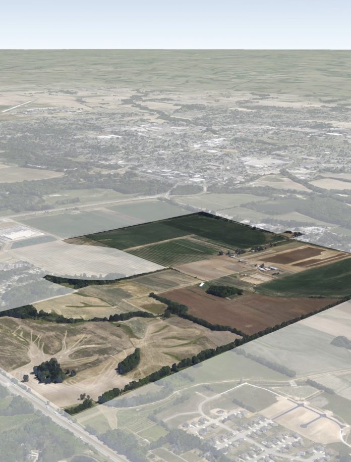
COLUMBUS, Ind. — Columbus Regional Health and the city of Columbus have presented a concept to turn a nearly 700-acre, hospital-owned site west of Columbus into a community that includes not only a new hospital campus, but also housing options, various types of developments and a great deal of green space.
A draft plan for the property, which is now being referred to as the “City View District”, can be accessed at columbus.in.gov/planning/columbus-current-projects/.
The site, commonly referred to as the Garden City Farms property, stretches east-to-west from Interstate 65 almost to State Road 11/Jonesville Road, and is south of the westside Walmart and north of the Bartholomew County 4-H Fairgrounds.
According to the city/county planning department, members of the public are invited to attend an open house on the draft plan on May 31 at NexusPark. Community members can drop in any time between 6 and 8 p.m. and will be able to review the plan, provide feedback and speak with project team members from CRH, the city of Columbus and master plan consultant Design Workshop. There will be a brief presentation of the plan at 6:45 p.m.
“With CRH intending to retain only a portion of the property, the remainder provides the possibility of adding future housing, jobs, and amenities to the community, but only with careful consideration of the property’s limitations, including flood hazards,” said Columbus planning officials. “The future development of the property also provides the opportunity for new street and trail connections, utility corridors, and other infrastructure envisioned by the City of Columbus Comprehensive Plan.”
City officials are considering adopting the “City View District Plan” as an element of the city’s Comprehensive Plan, which provides guidance for future land use and development in the community.
In addition to a future health care facility, the draft plan proposes a variety of residential neighborhoods, commercial centers, and a research and development campus. These areas would be connected to each other and nature via “open spaces, green corridors, and amenities that extend throughout the property,” said city planning officials.
“The plan envisions pedestrian-friendly neighborhoods connected by a mobility network including bike lanes, on-street parking, crosswalks, pedestrian paths and landscape enhancements that encourage walkability to green spaces,” the draft plan states. “The plan also establishes a new model for urban living with higher density residential choices with ease of access to convenience, entertainment and shopping. It will provide a renewed emphasis on improved health benefits to residents and visitors through enhanced connections to nature.”
For the complete story, see Wednesday’s Republic.


