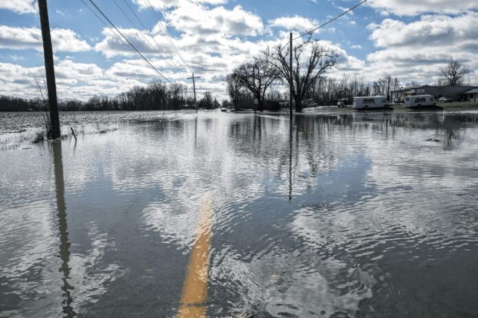
COLUMBUS, Ind. — Local property owners could see a change in their flood insurance rates as a result of recent changes to the city’s floodplain regulations.
The Columbus City Council has approved the first and second reading of an ordinance amending the flood hazard area standards of the city’s zoning ordinance. City/county planning director Jeff Bergman requested that the council do both readings in one night due to a deadline from the Federal Emergency Management Agency and the Indiana Department of Natural Resources (DNR).
The proposed changes were forwarded by the Columbus Plan Commission with a favorable recommendation and are mainly prompted by updates to the DNR’s Indiana Model Flood Damage Prevention Ordinance, Bergman wrote in a memo to the council.
The DNR serves as FEMA’s agent in Indiana, and the model ordinance sets the minimum standards communities must adopt in order to participate in the National Flood Insurance Program, which makes federally-backed flood insurance available to local property owners.
Bergman told the council that while the updates to the model ordinance were “fairly extensive,” the practical impact is expected to be minimal.
“They took the opportunity to rearrange the content in that document, change the wording in a lot of cases, provide some different organization,” he said. “Both myself and our floodplain manager, Chelsea (Cottingham), spent quite a bit of time with what the DNR provided to us. And a lot of those pieces, a lot of organizational changes — our finding was that there’s no real substantive regulatory change there that someone who’s developing business in Columbus is going to notice.”
The approved ordinance also includes additional changes that were recommended by the planning department. One of the most notable involves the city’s supplemental maps of the Haw Creek floodplain.
“The local map was developed and adopted following the 2008 flood and a finding that the FEMA Haw Creek map was of poor accuracy,” Bergman wrote in his memo. “FEMA has now completed a map update for Haw Creek, with their new map being more accurate and closely aligned with the city’s supplement. The proposed floodplain regulations, therefore, significantly narrow the scope of the supplemental maps, limiting their application to locations where floodwater breaks away from the main Haw Creek channel.”
These breakout areas are defined as floodplain rather than floodway on the FEMA maps and are therefore not protected from fill or other encroachments that could shift the flow of floodwater onto nearby properties. With that in mind, the city will continue its supplemental regulations in regards to “the required modeling of significant changes in these areas and prohibitions on development that would make flooding more severe for others.”
Bergman noted that repealing most of the supplemental maps may impact the discount level local property owners receive on their flood insurance. He explained that when communities adopt more stringent standards than the required minimum, this results in points that earn the area a discount with the National Flood Insurance Program. Columbus is currently classified as a Class 7 community, with local property owners receiving a 15% discount on flood insurance rates.
The city was previously a Class 8 community with a 10% discount but was bumped up after developing and adopting its own Haw Creek maps, said Bergman. The planning department expects that repealing most of those supplemental maps will result in a return to Class 8, though he added that this is not completely certain.
For more on this story, see Friday’s Republic.


